
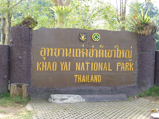
After our break in Railay we decided to get back on the travel wagon and head for the great outdoors of Khoa Yai National Park near Pak Chong.
We took a brief research detour to the city of Patong, which is on Phuket Island. The one night stay was enough for us to know we didn’t want to stay there in the future with my family. Patong is VERY touristy, the most we’ve experienced so far. And with that comes the frustration of saying “no, I don’t want a taxi or tuk tuk, no I don’t want a suit, no I would not like a massage” over and over again. We booked it out of there the following day and heading up north and then east to the city of Pak Chong.
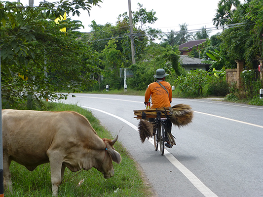
Pak Chong is a smaller city that doesn’t have many tourist come through. It’s always refreshing to stay in a town like this. The people are more curious about you and very willing to help without expecting you to visit their shop or buy something from them. Dave and I have come to realize we enjoy towns like this much more than any touristy town out there. The lonely planet guides usually do a really good job of creating touristy towns, so these small gems are a lot harder to find.
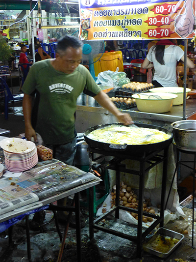
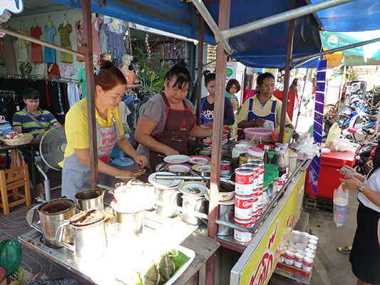
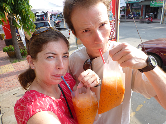
We were both exhausted from the 13-14 hour overnight bus to Bangkok and the 3 hour bus from Bangkok to Pak Chong, so we decided to stay in the closest hotel we could find. The hotel was called Pak Chong Hotel and was right across the street from the night market. We indulged ourselves in the best Pad Thai we’ve had so far in Thailand, these crepe type things, waffles, and Happy Milk shakes. All of these were a total of 160 Baht ($5.20), which is what Dave and I spent on dinner or lunch in Railay. These night markets or even the day markets are perfect for us and our budget.
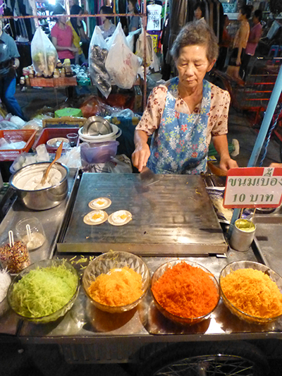
Making the crepe things.

The food station where we got our pad thai.

Best pad thai so far

Night markets are cheap and offer lots of yummy food.

Waffles. We tried the coconut, chocolate, and corn one. They all tasted like butter to us.

Happy Milk milk shakes.

The “American” breakfast that was included with the hotel. Some how they think Americans eat hot dogs and various other forms of pork for breakfast. Not sure where this came from.
The following day we decided to book a tour of the national park with one of the companies that offered it. We decided to go with Bobby’s Apartments and Jungle Tours rather than Greenleaf, which was the only other option, for multiple reasons.
- The cost of the tours was the same 1500 baht/person, BUT, the rooms were only 200 baht per night vs. 300 baht for Greenleaf
- They included free Wi-Fi – not sure if Greenleaf does, it’s not on their website
- Hot water showers
- They both have 5 stars for reviews
- And to top it all off, we had called Greenleaf the day before when we were undecided about doing a tour or not and they told us “no tour, then you can’t stay here, bye” which we didn’t appreciate at all
The tour was split into two days. The first included a swim in a natural spring, a tour of a cave where a bunch of bats live, a yummy fruit and cracker snack, and then watching millions of bats leave the cave at dusk. When I say millions, I am not exaggerating. It was amazing. They started to come out around 6:15pm and were still coming out when we left around 6:35pm. We were told it takes about an hour for all of the bats to leave the cave. It was an awesome experience that I know pictures won’t be able to capture.
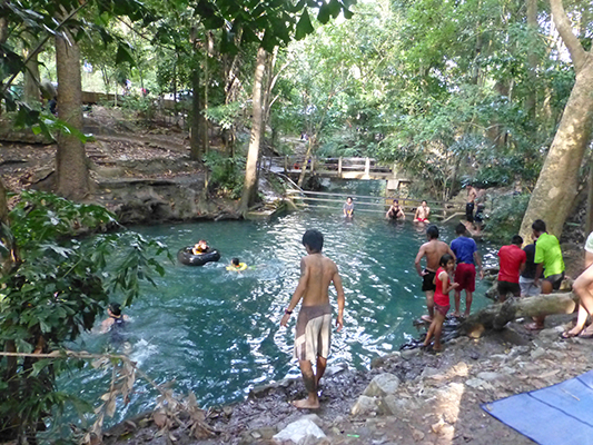
The water was a little cold, very refreshing. A lot of the locals went in with all their clothes on.
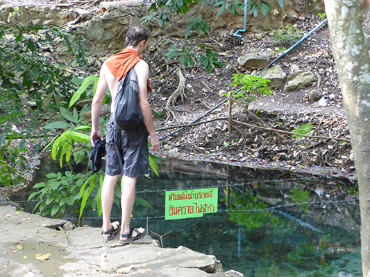
Dave checking out the source of the spring

Another section of the river
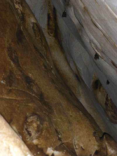
Bats sleeping in their cave.

Sun setting at the farm where the bat cave entrance was.
It’s a little hard to see them, but you can see a zig-zag trail of bats coming from the mountain.

Another picture trying to capture the bats.
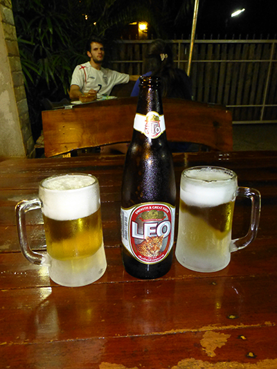
Enjoying a local beer after our first day.
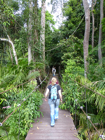
The second day was our trip into the Khoa Yai National Park and consisted of a visit to the visitors center, a hike through the jungle to look for animals and have lunch, a short walk to the biggest waterfall in the park, a swim in a smaller waterfall, and a never ending search for monkeys, birds, and elephants. Guess what? We got lucky and got to see all three plus a very poisonous viper and the pincers of a scorpion. Our guide did a very good job finding the animals and sharing the experience with us. I would recommend Bobby’s Jungle tours alone for the guide we had, of course, I didn’t experience other tour guides they might be just as good or better. I’ll never know.

Panoramic from the view point in the park. Reminded us of the smokey mountains.
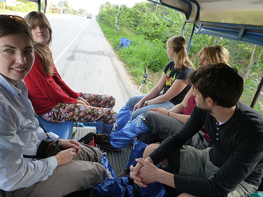
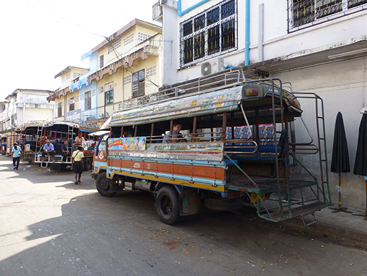
The pick-up truck that drove us around for the day and our fellow tourist.
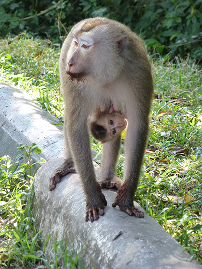
Monkeys and their babies.
Headed into the jungle to look for gibbons.

Found some. Apparently these guys are very shy and you don’t see them much. We got lucky.

They have a really cute face and are pretty fuzzy.
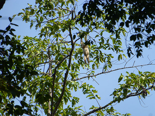
Hanging monkey.
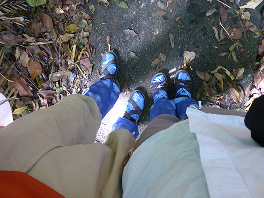
Our blue leech socks.

Sun bathing turtle

Barking deer

We also got to try some Holland candy. Which tasted like licorice and salt. They like them, I do not.

Scorpion do not like to be woken up during the day with a stick.

Still trying to get the scorpion to come out.

Huge termite nests.

Huge trees.
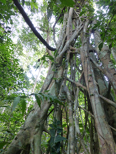
This is a fig tree. They grow on other trees until the other tree eventually dies and then gets eaten by termites.

Trying to wake up another scorpion. No luck.
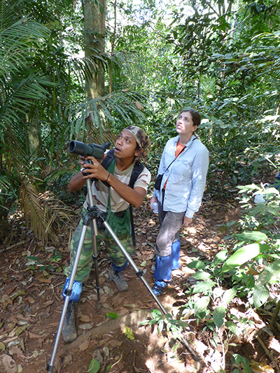
Bird watching is hard work. They move very fast.

Gross spiders
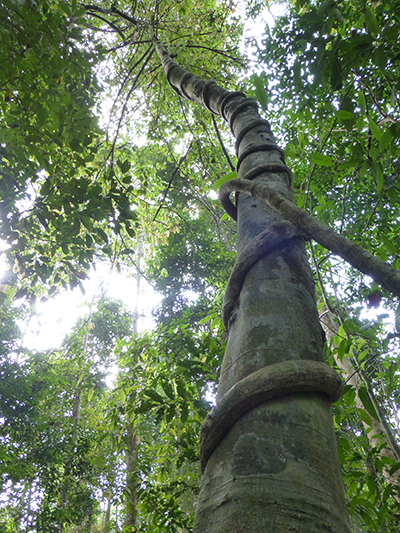
Cool trees.

Lunch was rice with lemon-grass curry. Very tasty.

Trekking through the jungle.
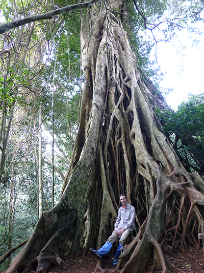
Large fig tree.

Lizard.

Very poisonous viper that was only about two feet away from the trail.
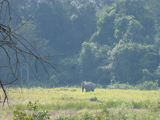
Wild Elephant!
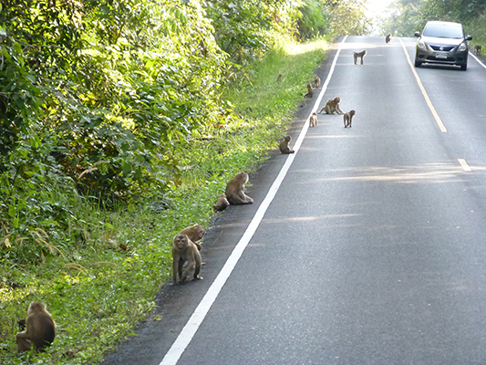
So many monkeys

Largest waterfall in the park.
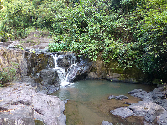
Swimming hole.

To finish the day off, a beautiful sunset.
The day after the tours we decided to go further east to Surin by train. We were told that the trains were a little unpredictable, but decided it would be easier than buses. Well, the train showed up 2 hours late and took about 45 minutes longer than we thought. But, it didn’t cost much and we were in no real rush, so it worked.
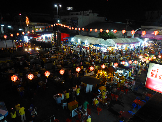
When we got off the train we walked into a festival happening in the square. We were told it was a Chinese Opera, but to us it seemed like a lot of singing, dancing, and carnival like games. We didn’t find the Chinese opera until the last night and it was very hard to hear and understand them. We think this was all for the king as it was the King of Thailand’s birthday the day after we arrived. The festival lasted the whole time we were there, which was very lucky for us as Surin is a small sleepy sort of town. But we did enjoy all of the food that came along with this festival. We did get Pad Thai again, but we tried some different things that looked like egg rolls and these cake type things with different toppings. We also got to see the whole town stop what they were doing and sing happy birthday to the king, or maybe it was the national anthem, either way, it was a cool experience. But this was only an added bonus for coming to Surin, we didn’t actually know that was happening until we got there.

Also, all the actors looked very distracted and annoyed that they had to perform at all.
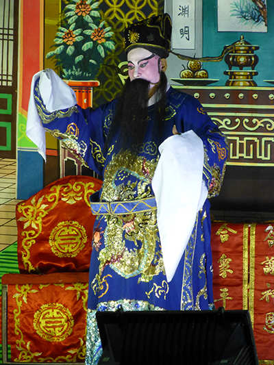
Again, they were speaking and singing in Chinese, so even the Thai people didn’t know what they were saying.
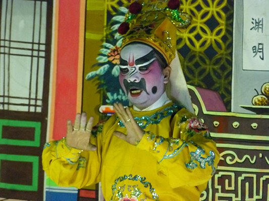
One of the characters in the opera
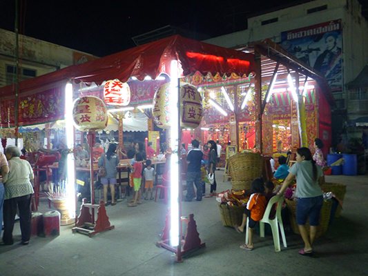
This was part of the Chinese Opera. They gave you burning incense to pray in a distinct order throughout this tent. We were someone lost and Dave burned himself numerous times. It was interesting though.

Traditional Thai dancing by 6 year olds.
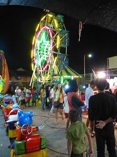
Rides and carnival games for the kids.

The cake dessert with different toppings. One was pork, we didn’t get that one.
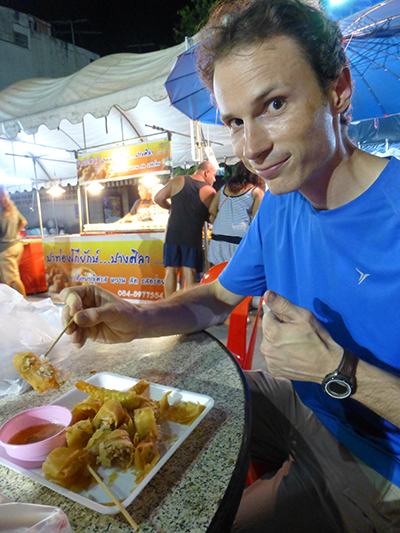
Dave trying the egg rolls.

I think this is jelly fish. We didn’t try it.

Roasted chestnuts.
This guy made some sort of egg dish all night on this giant frying pan.

The king projected on the big screen
Everyone stopped and singing what we think was happy birthday to the king.
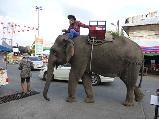
Surin was more famously known for it’s Elephant round up. Which has thousands of elephants playing games and such. It was in November so we missed it by a week or so. But we still saw elephants in the town.
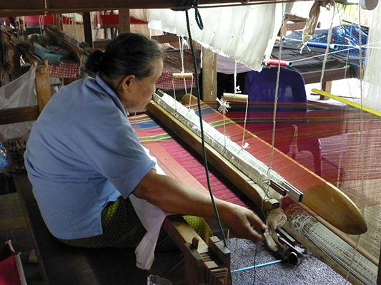
The reason we did come to Surin is the nearby silk villages. The experience to and from was more exciting than we had expected. Our hotel recommended we take a tuk tuk to and from the village as it would be easier. It was also going to cost an estimated 300 baht ($10), most likely both ways. In our book it says you can take a local truck for 15 baht or 30 baht ($1) total for both of us, a tenth of the cost. Being budget travelers we went with the cheaper option, we’ve taken local trucks before anyway, no biggie. We set off with only the name of the truck we were suppose to take and the town it was going to. We stopped in a local store where the 3 people working deciphered what we wanted from our poor rendition of the Thai words for truck and the town name. Eventually they pointed us in the correct direction, which was the market down the street. We managed to find the market from the direction they gave us, but there was 10-20 trucks all with Thai writing parked around the market. Again, we asked some locals using the same Thai words as before. This time they laughed after we mentioned the town, Ban Tha Sawang, and pointed us towards a street that held most of the trucks. Still not knowing which truck to take, we proceeded to ask every truck “Ban Tha Sawang?” and were pointed in the general direction of the trucks behind them with a laugh afterwards. Finally we found it, but people from other trucks were still yelling out “Ban Tha Sawang” and then laughing afterwards. We were amused by the whole experience and still not fully sure we were on the correct truck. I don’t think many non-locals opt to take these trucks.
Thai iced tea stand.
Iced tea in a bag!
The truck we took to the silk village.

We arrived!
Anyway, we were on the correct truck and made it to the village. We checked out how they make the silk and shopped around for a couple of hours. Finally decided on a silk handmade scarf for me and a silk scarf that we’re going to use as a table runner whenever we get a table back home.

Silk weaving location

A couple of the women weaving. We are still not sure what everything is for, we did not get an explanation.
We did see this women take this wooden stick and throw it back and forth. The stick had gold silk attached to the end of it.
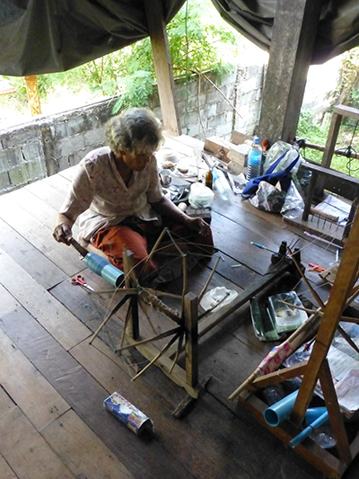
One of the weavers spooling the silk.
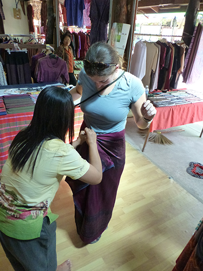
I tried on one of the silk skirts and asked them to tie it how they normally would have.
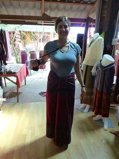
Pretty cool. But I would never wear this.
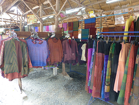
One of the many shops.
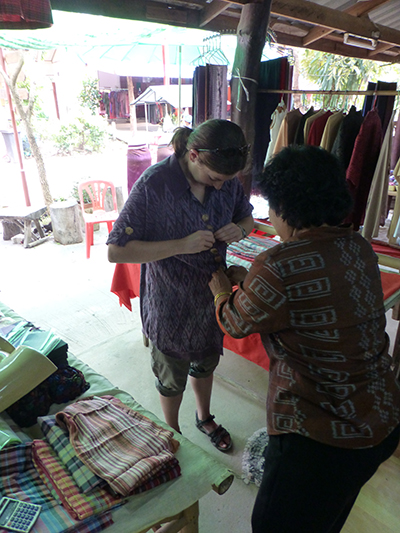
Trying on a one-size fits all dress. Not flattering on me at all.
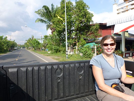
After this, we went to the location we were dropped off at and waited for a return truck. Thirty-five minutes into the wait a nice, older gentleman on a scooter asked us if we were waiting for a truck back to Surin. We said yes and he proceeded to tell us that sometimes they come and sometimes they don’t, so he was going to try and tell someone that we were waiting. We said thanks, both slightly confused as to what he meant. He went over to the side of the road and started to wave his hand, the equivalent of holding up your thumb, to hitchhike a ride back to Surin for us. Both of us kind of chuckled and wondered if this was 1. allowed and 2. normal practice. There was no stopping him, so we went along with it. Well, no luck and he said he was very busy. So we thanked him and waited another 10 minutes when we decided that after a total hour of waiting we would walk the 8km (5 miles) back if there was no ride. Another 10 minutes went by, 5 minutes before we decide to hoof it, Dave gets up the courage to start to wave at people. We had decided we would have better luck with pick-up trucks and we got lucky, there were three in a row and one of them actually stopped! Lucky us! Two nice young ladies in a pickup brought us back to town and wouldn’t even allow us to pay them. All in all, I’m glad we didn’t opt for the tuk-tuk, because the experience to and from the silk village ended up being better than the silk village itself.
This is just to show how rural the place was.
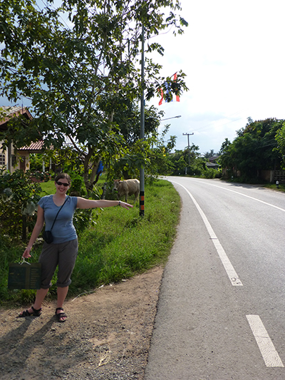
Hitchhiking. Dave actually did this for our ride.
Wahoo, we don’t have to walk back.

We didn’t get a picture with the ladies, but we snapped a shot of the truck.


